On this page
- Is anyone proposing to dredge tin off Cornwall now?
- What the seabed tin off Cornwall is
- The paper trail: a 1912 file and a 1983 plan
- What dredging does to the seabed
- What a tin-dredging application would have to show
- What the licensing rules say
- A short history and the mineral statistics: why the tin reached the sea
- Tin from the sea floor today: Bangka
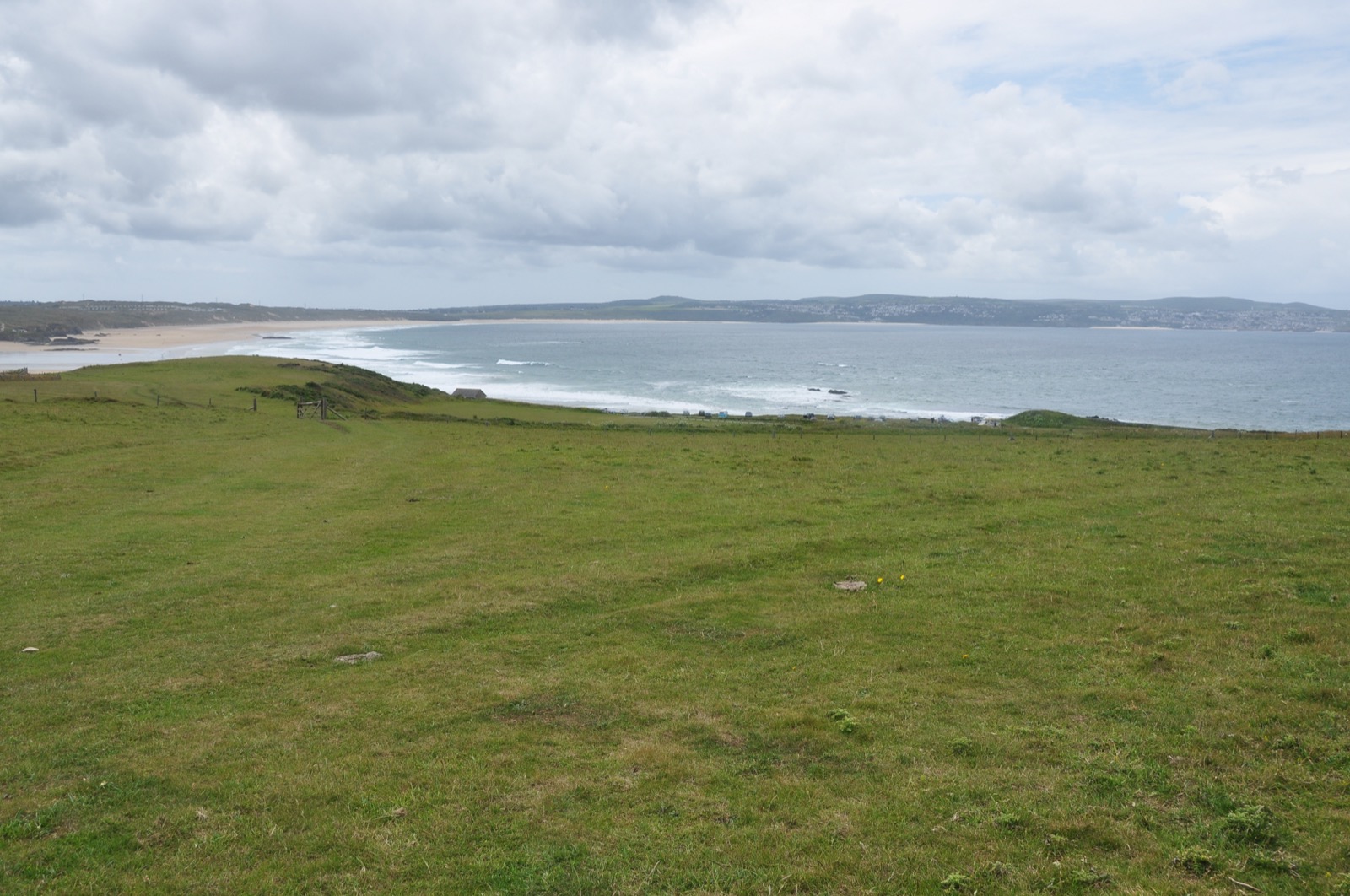
Is anyone about to dredge tin off Cornwall? The short answer is no, and the register is where you check. St Ives Bay is where the question keeps coming back, so this guide starts there, then explains what the seabed tin is, what dredging does and how to comment on an application. The mining story that put the tin there is in Cornish tin mining history. The offshore tin hub lists the rest of the series.
Is anyone proposing to dredge tin off Cornwall now?
No application has been published for public comment. The Marine Management Organisation keeps a public register of marine licence applications and decisions, held under section 101 of the Marine and Coastal Access Act 2009. On 21 October 2026 its “open for public consultation” tab held 11 applications. They were aggregate dredging at Area 407, pontoons, outfalls, pier works, dredge disposal and a wind farm cable among them, and none was for tin or for a location in St Ives Bay.
That is a snapshot of open cases, not of every case ever filed. Anyone can view applications and decisions, search by area or licence type and download the applications. If you only do one thing, search the register by area before you repeat anyone’s claim about a live proposal. It is free and it takes a minute.
To check a claim yourself, in order:
- Open the MMO public register of marine licence applications and decisions.
- Search by area or licence type, and look for tin, St Ives Bay or the stretch of coast in question.
- Read the application itself, which anyone can download.
- If a case is open, send a representation: the MMO consults for 42 days and invites comments from the public.
What the seabed tin off Cornwall is
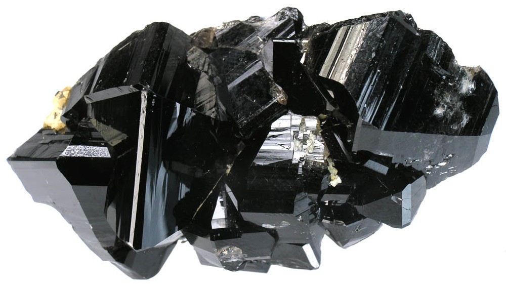
Offshore tin is cassiterite, the tin oxide mineral, sitting in sand and silt under the sea. Cassiterite was the chief tin ore throughout ancient history and remains the most important source of tin today. Because it is heavy and chemically resistant it collects in sediment as a placer deposit, and about 80% of mined tin comes from secondary deposits downstream of the primary lodes.
The tin off Cornwall owes much to people. The silt off the north coast contains cassiterite, most of it dumped into streams by the proprietors of 19th-century tin mines on the mainland. With the technology of the day, they were unable to extract the tin and viewed the silt simply as waste. Tin metal production peaked at about 12,794 tonnes in 1870, and the waste was frequently flushed into local water courses. Cores from coastal sediments show heavy metal concentrations above what normal weathering would produce.
Some tin was followed beneath the waves. Some Tin Coast mines stretched up to a mile under the sea. At Geevor a sub-incline was driven into Levant so that mining under the sea bed was carried out again, after a breach from the seabed into Levant’s upper levels had to be plugged.
The paper trail: a 1912 file and a 1983 plan
The idea of dredging this tin has a long paper trail in St Ives Bay. A file at The National Archives records applications to dredge alluvial tin in St Ives’ Bay, with a note dated 9 October 1912. It sits among the records of the Crown Estate and its predecessors.
A 1983 scheme went much further on paper. The plan was to dredge from the sea, off Cornwall’s northern coast, layers of silt that rivers had carried out over the centuries. Its backers estimated that the mud held about 10,000 tons of tin that could be extracted with modern techniques.
| Element of the 1983 plan | What was planned |
|---|---|
| Processing site | A plant at Gwithian, near St Ives |
| Method | Froth flotation, expected to account for about 10 percent of Cornwall’s tin output |
| Landing the mud | A pipeline attached to a floating buoy 700 metres from the coastline |
| First load | Planned for 1985 |
| Output | About 500 tons of tin a year until 2005 |
These were targets reported in May 1983, and no source used here records the scheme going ahead. The market it depended on broke in October 1985, the year the first load was due: tin prices fell from $12,389 a ton that month to $5,485 in June 1986.
What dredging does to the seabed
The documented effects come from sand and gravel dredging, the nearest comparable activity with a long scientific record.
Dredging removes sediment, changes the shape of the bottom and throws up a plume of cloudy water. How much that matters depends on the dredger and on the seabed it works. The first effect on seabed life is a drop in the abundance, species diversity and biomass of the benthic community.
Recovery is the argument. A peer-reviewed study at the Hastings Shingle Bank found the disturbed seabed capable of full recovery given enough time. That is not always the case and it depends on the dredging protocol used, for example sediment screening. Where a site is dredged repeatedly at high intensity, recovery can take more than seven years. In the end the biological impact of an extraction operation depends on the physical impacts and on the local seabed communities.
Cornish silt adds a question the aggregate studies do not cover: this sediment already holds heavy metals from mine waste, which is the kind of detail an environmental impact assessment has to examine.
What a tin-dredging application would have to show
The MMO regards extracting minerals by dredging as a project likely to have significant effects, which is the trigger for an environmental impact assessment. The aims of that assessment are to protect the environment and allow the public to play a part in making decisions. Some parts of the marine area are protected in law, including Marine Conservation Zones, European protected sites and protected species’ habitats. Near a Marine Conservation Zone an applicant has to show how it would reduce negative effects.
The public has a defined part. During the review the MMO consults for 42 days and invites representations from the public. The decision goes on the public register and to everyone who made a representation. To comment, find the case on the register.
What the licensing rules say
Taking tin from the seabed around England is a licensable activity. Section 66 of the Marine and Coastal Access Act lists removing any substance from the sea bed with a vessel as a licensable marine activity. It lists dredging too, and the Act defines dredging to include using any device to move material from one part of the sea or sea bed to another. No person may carry on a licensable marine activity except in accordance with a marine licence granted by the appropriate licensing authority.
| Activity | What applies in English waters |
|---|---|
| Removing material with a vessel | A marine licence is required to remove any substance or object from the seabed |
| Dredging | Dredging may need a marine licence in English waters or Northern Ireland offshore waters |
| Aggregate dredging | Always requires a marine licence |
| Survey work touching the seabed, inside 12 nautical miles | A Crown Estate seabed survey licence, unless the works fall within public rights of navigation or fishing |
| Survey work beyond 12 nautical miles | A licence where the activity relates to rights the Crown Estate holds, such as marine mineral extraction |
A seabed survey licence lasts up to 12 months. The standard application fee is £500, and issuing one can take the Crown Estate around 6 weeks. The MMO’s public register carries marine minerals extraction documents alongside renewable energy ones. In Cornwall the foreshore and estuary beds are partly Duchy of Cornwall land rather than Crown Estate land, as the Crown Estate seabed rights guide explains. For the full process, fees and appeal routes, read the UK marine licence guide.
A short history and the mineral statistics: why the tin reached the sea
Mining has gone on in Cornwall since the Bronze Age. The waste that now lies in the bay is mostly nineteenth-century: the industry ended in stages after the tin crisis of October 1985. Geevor and South Crofty each have their own timeline in the mining history guide, which also covers arsenic, china clay and slate.
Tin from the sea floor today: Bangka
Seabed tin is dredged for real in Indonesia. Treat it as a comparison, not a Cornish prospect. Miners on Bangka head out to scores of crudely built wooden pontoons equipped to dredge the seabed for tin ore. Pontoon pipes can be over 20 metres long to suck up sand from the seabed. Land deposits in Bangka-Belitung have been heavily exploited, leaving vast craters and highly acidic, turquoise lakes.
Not everyone there is happy about it. Fishermen say their catches have collapsed due to steady encroachment on their fishing grounds since 2014. Indonesia mined an estimated 55,000 tonnes of tin in 2024 and 61,000 tonnes in 2025, against China’s 71,000 tonnes in both years. For tin at the far deeper end of the scale, see what deep-sea mining is.
Common questions
Is anyone planning to dredge tin from St Ives Bay now?
No application has been published for public comment. On 21 October 2026 the MMO public register listed 11 marine licence applications open for consultation, and none concerned tin or St Ives Bay. The register also holds closed cases and decisions, and anyone can search it by area.
Is there tin on the Cornish seabed?
Yes, as silt that holds cassiterite, most of it dumped into streams by 19th-century mines. A 1983 estimate put about 10,000 tons of tin in the mud off the north coast.
How can the public object to a marine licence application?
During an environmental impact assessment the MMO consults for 42 days and invites representations from the public. Find the application on the MMO public register and comment on the case. The decision is added to the register and sent to everyone who made a representation.
Why did they stop mining tin in Cornwall?
On 24 October 1985 the International Tin Council announced that it could not pay its debts, and without financial assistance no Cornish tin producer could survive the crisis. Tin prices fell from $12,389 a ton in October 1985 to $5,485 in June 1986. The full account is in the Cornish tin mining history guide.
Is there still tin mining in Cornwall?
Not yet. South Crofty, the last tin mine in Europe, is being dewatered: by 12 October 2026 dewatering had reached more than 400 metres below surface, and the mine is permitted to commence underground mining, valid to 2071.
Can tin be mined from the seabed?
Yes. Dredging is one of the most economical ways to mine tin, and Indonesian miners already pump tin sand from the sea floor off Bangka.
Read next
Cornish tin
Cornish Tin Mining History: From the Bronze Age to South Crofty and After
How Cornish tin mining began, boomed and ended: granite geology, stannary law, steam pumping, the deepest mines, emigration, the 1998 closure and what remains.
UK marine licensing
UK Marine Licence Explained: Who Needs One, Who Grants It and What It Costs
How a UK marine licence works: the activities that need one, the MMO and the other regulators, the application steps, fees, conditions, appeals and penalties.
Deep-sea mining
What Is Deep-Sea Mining? Minerals, Methods, Rules and the Debate
What deep-sea mining is, which minerals it targets, who regulates it (the ISA, UNCLOS, NOAA), who holds exploration rights, the UK position and the debate.
Sources
- Indonesian tin miners target the ocean as reserves dwindle on land · Reuters (via KSL) · ksl.com · checked 20 October 2026
- American team is out to wrest tin from silt off the shores of Cornwall · The Christian Science Monitor · csmonitor.com · checked 20 October 2026
- St Ives' Bay: Alluvial Tin - Applications to dredge (CRES 37/934) · The National Archives · beta.nationalarchives.gov.uk · checked 20 October 2026
- Metalliferous Mine Waste in West Cornwall: The Implications for Coastal Management · M. G. Healy, Mary Immaculate College repository · dspace.mic.ul.ie · checked 20 October 2026
- Cassiterite · Wikipedia · en.wikipedia.org · checked 20 October 2026
- Tin · Wikipedia · en.wikipedia.org · checked 20 October 2026
- Placer deposit · Wikipedia · en.wikipedia.org · checked 20 October 2026
- Mineral Commodity Summaries 2026: Tin · U.S. Geological Survey · pubs.usgs.gov · checked 20 October 2026
- Dredging · Marine Management Organisation (GOV.UK) · gov.uk · checked 20 October 2026
- Removal of any substance or object · Marine Management Organisation (GOV.UK) · gov.uk · checked 20 October 2026
- Seabed survey licences · The Crown Estate · thecrownestate.co.uk · checked 20 October 2026
- Marine and Coastal Access Act 2009, section 66 (via Wayback) · legislation.gov.uk · legislation.gov.uk · checked 20 October 2026
- Marine and Coastal Access Act 2009, section 65 (via Wayback) · legislation.gov.uk · legislation.gov.uk · checked 20 October 2026
- Find out more about marine licensing · Marine Management Organisation (Marine Developments blog) · marinedevelopments.blog.gov.uk · checked 20 October 2026
- Visiting the Tin Coast · National Trust · nationaltrust.org.uk · checked 20 October 2026
- Marine case management system: public register (MMO), open for public consultation tab, read 21 October 2026 · Marine Management Organisation · marinelicensing.marinemanagement.org.uk · checked 21 October 2026
- Check the public register of marine licence applications and decisions (GOV.UK) · Marine Management Organisation (GOV.UK) · gov.uk · checked 21 October 2026
- Marine licensing: Information you may need to supply to support your marine licence application (GOV.UK) · Marine Management Organisation (GOV.UK) · gov.uk · checked 21 October 2026
- Effects of extraction of marine sediments on the marine environment 1998-2004 (ICES Cooperative Research Report 297, 2009) · International Council for the Exploration of the Sea · vliz.be · checked 21 October 2026
- Cooperative Research Report on the effects of marine aggregate extraction on fisheries, executive summary (ICES, 1991) · International Council for the Exploration of the Sea · vliz.be · checked 21 October 2026
- Assessment of ecosystem function following marine aggregate dredging (Journal of Experimental Marine Biology and Ecology, 2008) · University of St Andrews · research-portal.st-andrews.ac.uk · checked 21 October 2026
- Tin market and industry since the 1985 tin crisis · UNCTAD · unctad.org · checked 21 October 2026
- The story behind Geevor · Geevor Tin Mine · geevor.com · checked 21 October 2026
- Operations update for the South Crofty tin project (RNS, 12 October 2026) · Cornish Metals plc · investegate.co.uk · checked 21 October 2026
- The Collapse of the International Tin Agreement (IDS Bulletin, 1 October 1986) · Institute of Development Studies · ids.ac.uk · checked 21 October 2026
Image credits
- St Ives Bay, seen from Godrevy Point. — Nilfanion, CC BY-SA 4.0, via Wikimedia Commons
- Cassiterite, the tin oxide mineral, as crystals from the Viloco mine, Bolivia. Seabed tin is this mineral in grains of sand and silt. — Robert M. Lavinsky (iRocks.com), CC BY-SA 3.0, via Wikimedia Commons


Rules, fees and prices change: each source shows the date it was read. How we check facts · Report an error · Back to top.